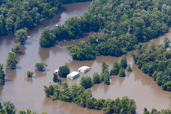
When record rains mingled with spring snowmelt in the lower Mississippi River Basin in April 2011, liquid disaster flowed southward and forced some hard choices: The U.S. Army Corps of Engineers blasted a hole in a levee in the river system to save the city of Cairo, Ill., from inundation—at the expense of more than 100,000 acres of farmland. Mandatory evacuations were ordered in Memphis, where floodwaters lapped at historic Beale Street. Officials opened two spillways in Louisiana to protect New Orleans and Baton Rouge, sacrificing farms and coastal oyster beds.
The crisis would ultimately cause $2.8 billion in damage, according to the Corps. And it is one of many recent examples of the way the restless river has pummeled surrounding communities. Unusual floods struck throughout the basin during winter 2015–16, and more swamped parts of Illinois, Arkansas and Missouri after torrential rains in 2017. Snowmelt swells the Mississippi every spring, but the river reached flood stage in Memphis a month earlier than usual in 2018 due to heavy February rains.
Now a new study raises the possibility much of the effort humans have put into trying to control the mighty river has paradoxically made its large floods more destructive. The magnitude of so-called 100-year floods—massive inundations defined as having a 1 percent chance of occurring in any given year—has increased 20 percent in the past five centuries on the lower Mississippi, researchers reported this month in Nature. The bulk of the increase has been in the last 150 years, when human engineering of the river has been most intense. “We’ve channelized the river, we’ve straightened it,” says Samuel Muñoz, lead author of the new study and an assistant professor of marine and environmental sciences at Northeastern University. “We’ve made the gradient steeper, and we’ve encased the river in concrete mats and lined it with levees.”
On supporting science journalism
If you're enjoying this article, consider supporting our award-winning journalism by subscribing. By purchasing a subscription you are helping to ensure the future of impactful stories about the discoveries and ideas shaping our world today.
The resulting physics is straightforward, Muñoz explains. With little leeway to meander and limited floodplain to spread over, the waters of the Mississippi in places are corralled into a relatively narrow chute, making peak flows higher than they would be otherwise. Muñoz and his colleagues estimate about 75 percent of the increase in 100-year-flood magnitude is due to river engineering, with the rest attributable to natural climate cycles. The study was not able to factor in the influence of anthropogenic climate change effects, though, leaving open the question of how much rising flood levels are driven by engineering and how much by a warming climate.
MAGNIFIED FLOODS
If left to its own devices, the Mississippi follows a sinuous and impermanent path. The river has “whipsawed” back and forth over the last 10,000 years, changing course when the sediment it deposits blocks its route, says Craig Colten, a geographer at Louisiana State University who was not involved in the new research. If not for Herculean human efforts, he says, the river would likely have switched its outlet during major flooding in 1973 and would empty into the Atchafalaya River—not the artificial route it now flows through before hitting the Gulf of Mexico.
Human control of the Mississippi has caused obvious problems along the Louisiana coast. Damming upstream, for example, traps sediments that would otherwise build up the river's delta; this makes the coast more prone to rapid erosion. But a natural-running Mississippi would devastate much of the economic activity that depends on the river, says Clinton Willson, a civil engineer at L.S.U. who also was not part of the new study. The river is a crucial shipping route, Willson notes, and big barges could never navigate natural meanders. Since a historic flood tested the Corps’s nascent taming of the river in 1927, Colten says, the three overarching goals of river engineering have been to protect navigation, New Orleans and the petrochemical industry along the lower Mississippi’s banks.
As much as humans have made over the Mississippi, there is a lack of understanding of how it behaved before we started mucking with it, Muñoz says. The oldest depth gauge records cover a mere 150 years, a period that started after human engineering began. Muñoz and his colleagues have attempted to extend this record back to roughly 1500 by sampling bottom sediments from three oxbow lakes in Mississippi and Louisiana. Oxbow lakes are former river channels that were cut off by sediment; they retain all the sands and silts the river carried when the now-lakes were still part of its main channel.
Sediment layers left by floods stand out because faster flows carry and deposit larger grains of sediment, Muñoz says. To more precisely date floods that occurred before formal record-keeping began, the team also turned to another data source—trees. Certain types including oak show cellular-level damage when swamped, and which is visible in the trees’ growth rings, providing an annual record of when the river overflowed.
The researchers also pulled in data from written records kept since the late 1800s. Taken together, their results showed 100-year floods in recent decades have been about 20 percent larger (in terms of cubic feet of water per second) than 100-year deluges 500 years ago.
That increase in flood discharge, or the volume of water flowing past a given point, is “what hydrologists sometimes call ‘flood magnification,’” Muñoz says. “You’re taking what could have been a moderate event and turning it into a larger event.” Teasing apart the factors that magnified the floods has been the tough part of the new research.
WHERE DOES CLIMATE CHANGE COME IN?
Along with the infrastructure humans have added to the river since the 19th century, climate also affects flood severity. Two natural ocean-temperature cycles influence moisture in the Mississippi Basin, but the team’s modeling found these could explain only 25 percent of the increased flood magnitude. Human engineering explains the rest, Muñoz says.
But that leaves out any role that global warming—and accompanying changes in precipitation—might be having on flood levels, says Scott St. George, a paleoclimatologist who wrote an editorial in Nature accompanying the new study.
Some research has attempted to untangle these climate threads. A study led by Utah State University meteorologist Simon Wang, published in 2017 in Geophysical Research Letters, found the precipitation that caused major flooding in southern Louisiana in 2016 may have been 20 percent heavier than it would have been without warming that has occurred since 1985. A 2016 paper in Hydrology and Earth System Sciences showed warming over the past century has likely increased the chance of that flooding by a factor of at least 1.4.
But how any global warming–fueled changes in precipitation affect flooding along the vast span of the Mississippi depends on when and where those changes happen, Wang says. Most of the river’s floods happen during spring when rains combine with snowmelt. So more or less spring rain or winter snow could affect flood levels. And where those precipitation changes occur—in the upper or lower Mississippi, for example—affects where the water enters the river, as well as which areas are likely to flood. Climate scientists are still trying to pick out these seasonal and regional precipitation trends.
At the same time that rainfall patterns might be shifting, rising temperatures could be affecting evaporation from soils and transpiration of moisture from vegetation, St. George says, affecting how much water ultimately makes it into the river and its tributaries. Humans have also been impacting that influx of water through changes in land use and agricultural practices, he says. “I think [the new study’s] explanation is plausible—and it’s possible,” he adds. “But I think it’s also true that we need some more information to really sort out whether human modification—river engineering—is the only thing that may have pushed the Mississippi River floods to be more severe.”
The uncertainty over these factors kept Muñoz and his colleagues from addressing the climate change question in this study, but he says they hope to do so in future work. One way to approach this, St. George says, is to look toward the upper reaches of the Mississippi, which are subject to less management. If flooding has increased significantly over long time periods on the river’s northern stretch, it would point to climate as the bigger driver, he notes, whereas minimal change would implicate river engineering.
Whichever turns out to be the main culprit, the Mississippi’s levees, spillways and other human-made structures are not likely to go away anytime soon—particularly because there is still excess capacity to handle high water flows—Colten says. The Morganza Spillway in Pointe Coupee Parish, La., for example, has only been opened twice: once in 1973 and again in 2011. Until that excess capacity is exhausted, Colten says it is unlikely the state or the Corps will fundamentally alter their approach to the river. “Decisions about managing the river are very much a human undertaking,” he says. “We have to know the size, we have to know the hydrology and the physics of rivers, but…those decisions are financial and political and regional, and don’t have a lot to do with the science.”