As the effects of Hurricane Harvey continue to torment southeastern Texas and parts of Louisiana, remote-controlled drone aircraft have offered a bird’s-eye view of the devastation in real time. For nearly a week YouTube users have been posting and sharing aerial footage of flooded roadways and decimated homes in and around Houston. Some of the video shows vehicles perilously plowing through deluged roadways—yet much of it is eerily absent of human activity.
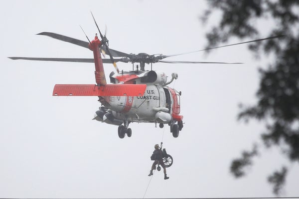
There is good reason for that: The U.S. Federal Aviation Administration (FAA) and other government agencies issued terse warnings for civilians to keep their drones out of areas where official rescue operations are using low-flying aircraft to locate and evacuate Harvey’s victims. (Much of the footage of the storm had until recently come from television news crews on the ground.) U.S. Air National Guard Maj. Gen. James Witham this week likewise warned civilian drone operators against flying over Harvey’s disaster zone, for fear the mere sight of unauthorized drones would ground rescue helicopters. U.S. Coast Guard Commandant Adm. Paul Zukunft expressed similar concerns.
Sidelining private drone use in rescue areas is not without controversy. Advocates for the technology want the FAA to find ways for civilian drones to coordinate with first responders searching for people who are still trapped, and possibly to deliver medical supplies and food to victims waiting for help. “Though the perceived risk of colliding with a drone may significantly hamper operations by deterring law enforcement and medical personnel from conducting search and rescue operations in the aftermath of Harvey, the actual risk of a serious accident as the result of a drone collision is very low,” says Chris Koopman, director of the Technology Policy Program at George Mason University’s Mercatus Center. A 2016 Mercatus Center report concluded that most consumer drones are so lightweight that they pose “negligible risk” to pilots and passengers, even if one were to strike another aircraft, Koopman adds.
On supporting science journalism
If you're enjoying this article, consider supporting our award-winning journalism by subscribing. By purchasing a subscription you are helping to ensure the future of impactful stories about the discoveries and ideas shaping our world today.
The FAA has not been eager to test that supposition. The agency’s most effective tool for scaring away unwanted drones is a Temporary Flight Restriction (TFR), which defines areas off limits to private drones in emergency situations and threatens “significant” fines for noncompliance. In some cases drone pilots can be fined even if a TFR has not been issued for a particular area, if first responders are already operating there. Just in case the FAA’s ban was unclear, the Texas Military Department—which includes the state’s Army National Guard, Air National Guard and the Texas State Guard—on Saturday posted a map on Facebook highlighting areas covered by the FAA’s Harvey TFR.
“Instances where drones have in the past interfered with emergency responders are unfortunately easy to find,” says Brandon Stark, director of the University of California Merced’s Center of Excellence on Unmanned Aircraft System Safety. One example—unrelated to Hurricane Harvey—occurred on Sunday, when an unauthorized drone flight shut down helicopter firefighting operations over western Montana’s Rice Ridge as responders fought to contain the blaze and officials evacuated nearby residential areas.
Despite emergency responders’ pleas for drone pilots to stay out of the way, there is still plenty of aerial footage documenting Harvey’s assault on Houston. This is not necessarily taken in violation of the FAA ban, however. The first FAA flight restrictions for the Houston area covered only a small portion of areas affected by flooding and did not take effect until 7 p.m. local time on Monday, almost three full days after the hurricane made landfall, Koopman says.
Brian Emfinger, who used his drone to film washed-out areas of Rockport, Texas, avoided interfering with emergency operations by getting the aircraft in position on Saturday morning before any emergency work had begun. “The only battle I waged was whether my drone was going to function after putting it through the storm’s wind and rain,” says Emfinger, a TV photographer sent to the Houston area by KATV Channel 7 in Little Rock, Ark., to cover Harvey. A veteran drone videographer and storm chaser, Emfinger avoided shooting drone footage again until Tuesday, when he took aerial video of flooding in Beaumont, Texas, which had no flight restrictions at the time.
Veteran drone videographers like Emfinger tend to have a healthy respect for first responders. “If I see any airplanes, much less a rescue aircraft [during an emergency], I’m just not going to fly,” he says. “I’ve talked to helicopter pilots and know that they are especially are wary of drones. Our strategy is, if you see or hear a helicopter you’re getting to the ground, even if that means putting your drone in a pond.”
Just in case a drone pilot’s moral compass wavers, some drone makers equip their aircraft with “geofencing” software that provides access to maps and can be updated whenever the FAA issues a flight restriction. “If the drone determines its current location is in restricted airspace, then it will disallow the pilot from turning it on,” Koopman says.
The drones that Emfinger uses both personally and professionally are made by a company called DJI, and feature mapping software that restricts their use in areas with TFRs. Emfinger disagrees with automated restrictions, especially when they interfere with his professional assignments. “There are times when you might have special authorization from the FAA to fly legally in a particular location, but DJI’s program will stop that from happening,” he says. In one instance, Emfinger could not operate his drone to take footage of a college football stadium he had been sent to cover. The FAA had mistakenly issued the TFR a day early—in an attempt to keep drones from flying over the stadium while the game was underway—but the DJI software complied with the order anyway and refused to take flight.
Both Stark and Koopman echo Emfinger’s sentiments, seeing automated drone shutdowns as a missed opportunity. “I know there are airborne emergency operations going on in Houston as we speak, but I also know there is a whole community of [drone] operators ready to coordinate with local authorities to aid in whatever way they can,” Stark says. Koopman adds that drones could prove to be very capable of helping search and rescue efforts in Harvey’s aftermath. “Among other things, drones can observe the extent of the flooding and provide valuable real-time information to first responders,” Koopman says. “They can even be equipped with heat-sensing cameras that can scan houses for anyone who may be trapped inside.”
Those are important areas that the FAA and emergency responders will have to consider, given Harvey’s vast footprint. Emfinger—who has chased storms for years (including Hurricane Katrina) and is back in Arkansas with his drones to document Harvey as the storm makes its way inland—says this is the worst disaster he has covered. Given how much territory the hurricane has destroyed, he says, “even the word ‘historical’ is probably not strong enough to describe what they’re dealing with down there.”