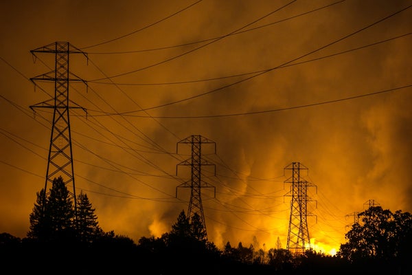
During his eight years as community alert and warning manager in Sonoma County, California, Sam Wallis has repeatedly watched wildfires roar through the cities and small towns he protects. Often with little warning, fires have razed homes and charred the area’s picturesque hillsides, valleys and vineyards just north of San Francisco. Wallis had to evacuate his own home last year. And in 2017 his property was strewn with wind-blown debris from the deadly, 37,000-acre Tubbs Fire, one of the most destructive in California’s history. “The Tubbs Fire was the seminal event, an absolutely massive and fast-moving fire that we had no way of tracking,” Wallis says.
Once that blaze was squelched, several local agencies began installing a system of tower-mounted cameras, called ALERTWildfire, to look for smoke and flames so that fires could be attacked before raging out of control. Sonoma County’s 21 high-powered devices scan and photograph fire-prone areas. Every 10 seconds they send images that help confirm—and sometimes discover—flare-ups. Dispatchers in the county’s fire emergency center try to keep tabs on these incoming images, displayed on a wall of video monitors, and alert emergency crews if they see any suspicious smoke. They also take 911 calls from citizens.
It is a lot for any human to do, particularly when the stakes are so high, Wallis says. “You can’t really have somebody staring at that wall all day and all night, waiting for fire to happen.”
On supporting science journalism
If you're enjoying this article, consider supporting our award-winning journalism by subscribing. By purchasing a subscription you are helping to ensure the future of impactful stories about the discoveries and ideas shaping our world today.
Today he has a powerful—and indefatigable—new partner: Since May 1, artificial intelligence software linked to the cameras has been sifting through all the images, comparing them with historical photographs of the same spots at a rate impossible for human eyes. If anything looks out of place, the system alerts the dispatch center. The goal is to investigate potential fire starts earlier and get firefighters to them more quickly, says Graham Kent, who developed the ALERTWildfire system and directs the Nevada Seismological Laboratory at the University of Nevada, Reno.
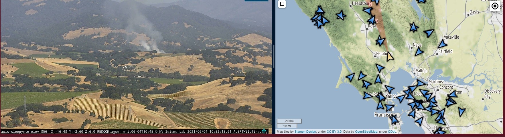
ALERTWildfire camera picked up smoke from a controlled burn. The map on the right indicates its location just east of Petaluma, Calif. Credit: ALERTWildfire.org
In the weeks since Sonoma County fully activated the technology, AI has bested 911 calls by as much as 10 minutes—a small time window but one that can mean the difference between a scorched smudge and a runaway wildfire. “I’m cautiously optimistic that AI is a service that can help keep my county safe,” Wallis says.
The system is improving weekly as dispatchers learn to use it, says KT McNulty, executive director of Sonoma’s fire and EMS dispatch center. Software developers have added a data dashboard, audible alerts and other features that refine the coordination between AI and human operators, she says.
The AI algorithms still have some learning to do, and sometimes 911 calls still beat them. Neil Sahota, an inventor who has worked with IBM and advises the United Nations on AI issues, estimates the system will need to “see” at least 70 real-world blazes to have sufficient information. It also needs to learn the “vocabulary” of the Sonoma County terrain—to differentiate between smoke and clouds or fog, for example (once, the AI was triggered by steam from the Geysers, a local geothermal field). Eliminating such false positives will take time, says Sahota, who is not affiliated with the Sonoma project. Wallis hopes the system can start providing consistently dependable intelligence by November.
Other California communities have been watching Sonoma’s pioneering AI surveillance. Some are about to make commitments to work with the South Korean firm Alchera, which provided Sonoma’s system, Kent says. The company’s goal is to extend its AI to all of the 850 ALERTWildfire cameras across six Western states, says Robert Grey, an Alchera representative.
Similar early-detection technology is being tested in New Mexico, where land managers are using AI to analyze infrared satellite imagery and report data indicating surface “hotspots” that could be early fires. In Brazil, scientists have deployed an AI system that processes images from tower-mounted 360-degree cameras, alerting local officials about any apparent fires. In three years, the system has reduced fire-detection time from an average of 40 minutes to less than five. Kent is also launching a camera network called BushfireLIVE, which will use Alchera’s AI system in the district around Australia’s capital city of Canberra.
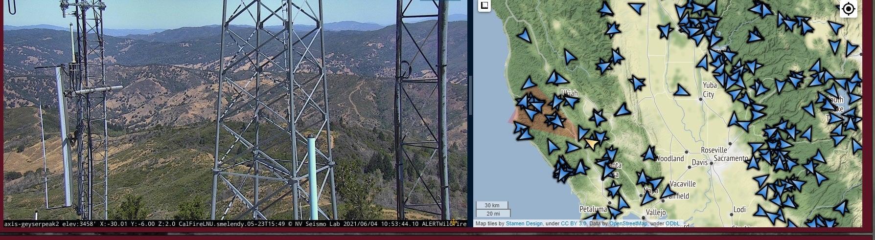
ALERTWildfire camera is positioned to view the Geysers area of Sonoma County and mounted on an existing utility tower. The map on the right shows the camera’s location with a white arrow. The blue arrows indicate other cameras in the region. Credit: ALERTWildfire.org
Eventually AI detection networks may even be able to measure the risk of fires before they start. This requires training a system to combine historical data from camera images with a variety of factors known to contribute to a fire starting, such as precipitation, humidity and moisture levels in vegetation. AI can process and assemble millions of such data points in real time, far faster than humans can. “When all these puzzle pieces snap together into a potential for fire, we will be able to predict where fires might actually break out,” Sahota says. After identifying potential hotspots, officials could take steps to reduce risks by clearing dry brush, setting controlled backfires to burn away potential fuels, and other measures.
In Australia—where fires scorched more than 47 million acres and killed a total of 34 people in 2019 and 2020—land managers are using Google Earth, climate data and AI systems to test this technology. Scientists who studied Australian fire data from 2001 to 2019 found the most important driver of wildfires there was soil moisture, followed by air temperature and an index of drought levels, according to a paper published last year in Remote Sensing. Such findings help prioritize which variables an AI should monitor.
Sonoma County has about 20 months to decide whether to invest in a long-term contract with Alchera. To make that decision, Wallis will be evaluating the AI’s speed and consistency—“exactly how those alerts beat or didn’t beat the 911 calls,” he says.
As California and the rest of the U.S. West ramp up for another potentially destructive fire season, Kent has high hopes AI will lead to faster fire responses. But he urges citizens to continue reporting fires on 911 and Twitter. Even the century-old system of fire towers, with human lookouts reporting by radio and tree-to-tree telephone lines, still has its place. “We are in such a pitched battle [with] wildfire that you don't want to take any tool in the chest and throw it away,” he says.