Six million years ago the Mediterranean Sea was a very different place than it is today. Plate tectonics had closed the Strait of Gibraltar separating modern-day Spain and Morocco, leaving the Mediterranean cut off from the Atlantic Ocean. The newly enclosed sea succumbed to evaporation, its water level falling by thousands of meters, turning it into a desertlike environment pockmarked with shallow pools as salty as today’s Dead Sea.
One hypothesis suggests a megaflood rapidly refilled the Mediterranean. Now, a study of buried ocean sediments near Sicily shows this flood may have washed all the way into the sea’s partially filled eastern basin via a waterfall about 1,500 meters high.
Floods have punctuated the Earth’s history, but the “Zanclean megaflood”—so named for the geologic age during which it occurred (from 5.3 million to 3.6 million years ago)—is thought to be the largest ever, the new research, published in January in Scientific Reports reveals. These findings build on a 2009 Nature study, which showed water violently rushed into the desiccated Mediterranean after shifting tectonic plates reopened the Strait of Gibraltar. The deluge carved a 200-kilometer-long channel along the seafloor as it filled the western part of the basin.
On supporting science journalism
If you're enjoying this article, consider supporting our award-winning journalism by subscribing. By purchasing a subscription you are helping to ensure the future of impactful stories about the discoveries and ideas shaping our world today.
“Over the course of only a couple of years there was huge environmental change over a large portion of the Earth’s surface,” says Daniel Garcia-Castellanos, a geophysicist at the Institute of Earth Sciences Jaume Almera in Barcelona, and lead author of the Nature study.
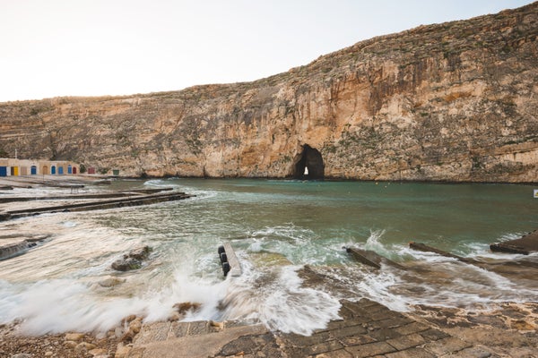
But an open question is whether the flood also tore through the eastern Mediterranean, over a seafloor cliff separating the shallower continental crust in the west from the deeper oceanic crust in the east. This natural barrier, called the Malta Escarpment, towers more than three kilometers high in some places and is located to the east of modern-day Sicily and Malta. The new study, led by Aaron Micallef, a marine geologist at the University of Malta, found the sediments buried near Sicily were likely deposited by the megaflood—a finding that implies a violent influx of water throughout the Mediterranean. “A catastrophic event like the Zanclean megaflood would undoubtedly have left its mark in the sedimentary rock record,” says Lauren Shumaker, a geologist at the Colorado School of Mines, who was not involved in the research. “The authors have laid out some good evidence showing they may have found that mark.”
Micallef and his colleagues focused on the Malta Escarpment because megaflood water flowing east would have encountered this natural blockade, making it a logical place to find sediments deposited by water that breached the cliff. The researchers used seismic reflection imaging, which involves directing sound waves toward the sea bottom and measuring the time it takes them to return. Essentially an x-ray of the seafloor, this technique allowed the team to reconstruct the thickness and likely composition of buried sediment layers.
One of those layers stood out from the others; it was a jumbled mix of angular pebbles and boulders. “It doesn’t have internal layering like marine sediments normally do,” says Garcia-Castellanos, who was also a co-author of the new study. This irregularity implies the sediments—up to 800 meters thick in places—were laid down “quickly and haphazardly,” Micallef says, consistent with the material being transported by rushing water. Furthermore, this layer lay just to the east of Noto Canyon, a large undersea gorge running through the Malta Escarpment. The canyon bears a curious geologic scar on its western side; a channel 400 meters deep runs through its hard limestone. This feature, similar to the signatures of erosion seen near the Strait of Gibraltar, was probably caused by flowing water, the researchers reasoned. “We think we found this breach just to the southeast of Sicily,” Micallef says.
The scientists estimated water coursed over the escarpment through Noto Canyon, flowing at up to 160 kilometers per hour and spilling over a 1.5-kilometer-high waterfall into the Mediterranean’s briny eastern basin. Micallef and his team have hypothesized, based on earlier calculations by Garcia-Castellanos and his colleagues, that the torrent boosted the sea level in the eastern Mediterranean by at least 10 meters per day, refilling the entire sea in just a few years.
It is difficult to imagine this environmental transition, Garcia-Castellanos says. “We don’t have present-day analogues.” These rapid changes probably affected the local climate and the circulation of Atlantic seawater, Micallef and his team propose.
The Zanclean megaflood clearly altered a wide swath of the planet’s surface, but may not be unprecedented, says Garcia-Castellanos. Other large ocean basins have probably closed and reopened five or six times in Earth’s history, and will likely do so in future, he says.* “In a few million years the Mediterranean will probably separate again from the Atlantic.”
*Editor’s Note (3/28/18): This sentence was edited after posting to correct an error. The original erroneously stated the Strait of Gibraltar had closed and reopened multiple times in Earth’s history.