We have so radically transformed our cities and towns that few visual clues remain to their natural landscapes and waterways. Creeks have been holstered into pipes. Wetlands have been filled with dirt and paved. Yet signs of vanished waters stubbornly pop up in unexpected places, such as seasonal “ghost creeks” running through basements. Joel Pomerantz—a San Franciscan who has devoted three decades to rediscovering the city’s historic waterways—checks for traffic, then guides me to a manhole in the middle of residential Eddy Street near busy Divisadero. Cocking our heads, we hear the sound of rushing water. When that sound is constant, Pomerantz says, as it is here, it’s a creek imprisoned in a sewer pipe—not somebody flushing.
Today subverted water is reappearing in inconvenient ways because we have constrained the space it once had to ebb and flow, and climate change is amplifying storms and droughts. To cope, cities are increasingly funneling runoff into green infrastructure such as permeable pavement and bioswales (essentially shallow ditches dressed with water-loving plants). But a scientific research center, the San Francisco Estuary Institute (SFEI), is proposing a more ambitious approach that involves redesigning cities to brace for bigger rainstorms, longer droughts and stronger heat waves. “We need to be surrounded by marshes and [tree] canopies and floodplains; those are the buffers,” says Robin Grossinger, a historical ecologist at SFEI. “Otherwise our cities are brittle and actually multiply the intensity of environmental catastrophes.”
Before such a transformation can occur, historical ecologists first investigate how a place’s natural systems worked prior to development—because the modern landscape provides only fragmentary clues. SFEI is now taking on San Francisco by researching and mapping the historic waterways and biodiversity of the northern third of the city, while educating the public about the vanished landscapes of yore. Called Hidden Nature SF and led by Grossinger’s colleague, historical ecologist Sean Baumgarten, the project is a partnership with the Exploratorium science museum, the Presidio Trust (a federal agency that co-manages the Presidio, a former army base that was decommissioned in the 1990s and is now a vast urban park), and the nonprofit Wildlife Conservation Society. The public outreach aims to encourage residents, decision makers and funders to “get inspired by a nature-based city,” and to include “local nature in designing the city,” says Peter Brastow, biodiversity coordinator with the city’s Department of the Environment.
On supporting science journalism
If you're enjoying this article, consider supporting our award-winning journalism by subscribing. By purchasing a subscription you are helping to ensure the future of impactful stories about the discoveries and ideas shaping our world today.
COMBING THE ARCHIVES
SFEI will not have to start from scratch: Pomerantz has mapped San Francisco’s historic waterways and published his work on his Seep City website. A local nonprofit organization called Nature in the City has mapped native ecosystems. San Francisco’s Public Utility Commission has also diagrammed old waterways. Hidden Nature SF will work from this existing research and build on it, Baumgarten says. “There’s currently no comprehensive, rigorously documented, map-based reconstruction of the historical landscape,” he notes. The database that underlies SFEI’s maps, composed of multiple layers, can be augmented over time—making it a potentially useful tool for city agencies—Brastow says.
One rainy day I meet Baumgarten and his then-colleague Erin Beller (now with Google’s Urban Ecology Program) at the Bancroft Library of the University of California, Berkeley, so they can show me the historical ecology ropes. The library’s rare books and historical documents can only be perused in the reading room, which we enter through multiple checkpoints after agreeing to many idiosyncratic rules.
The first book I examine is a traveler’s account of a ship journey to San Francisco, then called Yerba Buena, several years ahead of the gold rush of the mid-1800s. At one point the author is sent to fetch water from Sausalito, a town just north of today’s Golden Gate Bridge, “as the water at Yerba Buena was bad, and very scarce.” He calls Sausalito “the watering place”—which makes sense because its name means “little willows” in Spanish, and willows are streamside trees.
Next up is an 1860s legal document about a land rights dispute. Testimonies from people who lived around Mission Dolores (a Spanish church founded in 1776 in the heart of modern San Francisco’s Mission District) mention proximity to a river or well. One witness drew a simple map showing trees, which are signs of water in a chaparral landscape, Beller says. Although a drawing of trees or a story about a water run to Sausalito is not much to go on, each piece of information is a snapshot in time and space.
Researchers rate each datum for accuracy, using a system developed by SFEI. “A lot of it is context,” Beller explains. “Who made this? What was their motivation? What would their blind spots have potentially been?” Over more than 20 years of work informing numerous landscape restoration projects in the Bay Area, SFEI has come to know and trust certain sources—and even individual mapmakers who seemed especially persnickety about details.
Next, to visualize more completely what a past landscape looked like, environmental scientists and analysts at SFEI weave the fragments together by creating a geographic information system (GIS) map. This starts with data sets such as historical and modern aerial photographs, 19th-century U.S. Geographic Survey topographic maps, coastal navigation maps, and century-old maps from the U.S. Department of Agriculture demarcating 30 different types of soil (a good indicator of water capacity and vegetation). Then they add the weighted data gathered via research.
The maps are a powerful way to spark the interest of the public and decision-makers, Grossinger says, noting that it is inherently fascinating “to see your place, how it looked: ‘Wow that same tree is here. Here’s why this creek is over here.’” Beller agrees, adding that historical photos also intrigue people, providing “glimpses of … this both foreign and familiar place.” These insights help people understand things like why a certain area floods repeatedly—and begin to consider what might be done about it.
Although partially restoring natural systems in a densely populated city like San Francisco can seem nearly impossible, looking at historical maps over time, “you realize things don’t last that long,” Grossinger says. “Much will be rebuilt in 50 years.” In California, a lot of water and flood-control infrastructure was built 70 years ago and is nearing the end of its lifespan, he adds. “There’s an enormous opportunity to redesign our systems and use nature-based processes in a bigger way.”
TAKING IT TO THE STREETS
In a bid to kindle a public reimagining of the urban landscape, Hidden Nature SF will introduce people to San Francisco’s past with nature walks in the Presidio and “ecological detective office hours” at the Exploratorium, Baumgarten says. In these presentations, SFEI researchers will pose whodunits in which extirpated critters are victims and certain land use changes are the cause. The wildlife data is “eye-opening,” Baumgarten adds. With certain species, the researchers found 40 to 50 mentions—“and then they just disappear.” People will also be able to post their observations or questions about nature and water on a map in the Exploratorium. Public engagement “helps to shift people’s understanding of what the baseline ecology was, and recognize opportunities for restoration,” Baumgarten says.
The San Francisco Public Utilities Commission (PUC) already has green infrastructure projects in the works—based in part on its own historical research—to help relieve pressure on the combined stormwater-sewer system, says Sarah Minick, program manager at the commission. A common urban development practice worldwide has been to bury creeks and wetlands, and build on top of them. But now people are realizing this has increased urban flooding and destroyed important habitat. To counter those problems, PUC will “daylight” (or uncover) the buried, ephemeral Yosemite Creek in McLaren Park near the city’s south end. The project will also collect stormwater to help alleviate local flooding. Along the Wiggle, a bike route that traces a ghost stream around the base of the city’s famous hills, the PUC has built stormwater gardens. “Cyclists are looking for the path of least resistance, just like water,” Minick says.
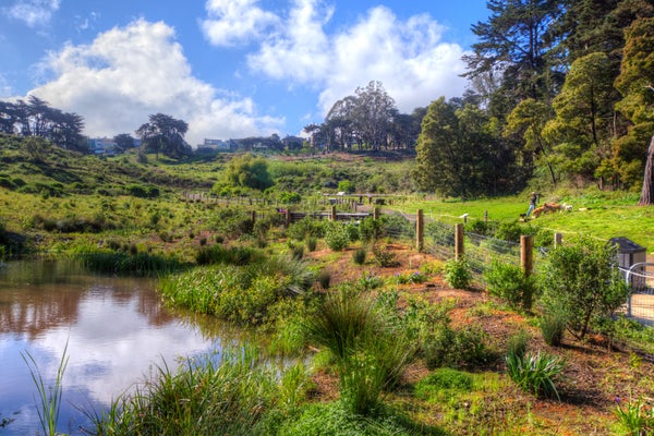
The sprawling Presidio has comparatively large opportunities to restore watersheds and biodiversity. After the Presidio Trust took over management in 1996, it did its own historical ecology research to inform restoration, says Lew Stringer, the trust’s associate director of natural resources. A signature project was restoring the base’s Crissy Field airstrip to 20 acres of tidal marsh and daylighting thousands of feet of freshwater creek that fed it. A new initiative will restore a neighboring six acres of tidal wetland. “These projects also serve as green infrastructure,” because they route water from the adjacent built environment to ease pressure on the storm sewer system, Stringer says.
These efforts to restore aspects of San Francisco’s natural hydrology are also supplying some local water to residents. Although 8,000 people who live and work in the Presidio’s historic buildings get about 80 percent of their supply from a local waterway called Lobos Creek, Stringer says, most San Franciscans have not used local water since before the city infamously dammed Hetch Hetchy, a valley near Yosemite National Park, to supply itself with water from 167 miles away. But in 2017 the PUC began pumping groundwater to augment the public supply from a site in the city’s southwest, an aquifer refilled by green infrastructure projects.
Restoring creeks and native plants has also allowed Presidio Trust to reintroduce animals such as Pacific chorus frogs. Now “you hear this incredible sound of frogs at night,” Stringer says, ambiance “that had been lost for 100 years.” Three years after trust wildlife ecologists put variable checkerspot butterfly larvae on their host plants—sticky monkey-flowers and bee plants—“they are the most abundant butterfly in the Presidio,” Stringer adds. “There are clouds of them.” These stories bring hope, he says, in a time of heartbreaking daily news about declines in biodiversity and intensifying climate chaos.
And while more developed parts of the city may not be tenable homes for frogs at the moment, “we actually have a lot of space to do stuff,” Grossinger says, ticking off green roofs, greenways, pocket parks, larger parks, street trees and schoolyards.
The Hidden Nature SF team says its work could ultimately lead to finding more places in the city to create space for water to stall upon the land. “That’s where the good stuff happens” for hydrology and biodiversity, according to Grossinger. While that may seem improbable in a crowded city, “nature’s going to take that space one way or the other,” he notes. “We see that with floods and sea level rise.” It is less disruptive for humans to make space proactively. “The good news is that’s going to make our cities better,” Grossinger says, “safer and healthier, with more clean water, more water storage—places people want to live.”