Tropical Storm Barry is lumbering toward the coast of Louisiana and is set to dump monumental amounts of rain. Although New Orleans and the rest of southeastern Louisiana are expected to see the worst rainfall and have been a key focus of emergency preparations, Barry’s impacts will extend much farther inland—and will last for weeks after the storm peters out—as it will add to the already historical flooding along the Mississippi River.
“Everything is running high right now” along the Lower Mississippi River, says Darone Jones, operations director for the National Water Center in Tuscaloosa, Ala. “This rain is just going to exacerbate the situation.”
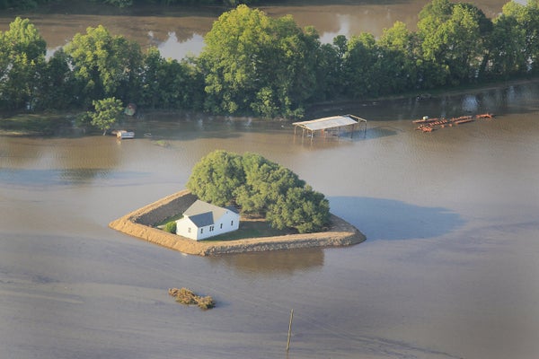
Barry could drop up to two feet of rain in some isolated spots in southeastern Louisiana. The combination of rainfall, storm surge pushed ashore, and already high water levels in the Mississippi will likely cause major flooding in the region. River levels in New Orleans are expected to stay within the capacity of the levees that protect the city, however.
On supporting science journalism
If you're enjoying this article, consider supporting our award-winning journalism by subscribing. By purchasing a subscription you are helping to ensure the future of impactful stories about the discoveries and ideas shaping our world today.
As the storm moves slowly north it will take that flood risk with it, and its rainier eastern portion will go right over the Mississippi River basin. The river and its tributaries have been at flood stage for months because of heavy snowmelt and an extremely rainy spring, meaning they will have very limited capacity to absorb the four to 10 inches of rain that are expected to fall throughout Mississippi, eastern Arkansas and western Tennessee. Some spots could see even higher rain totals.
This will further swell streams and rivers, partly because the rain can come in intense bursts that cannot be quickly absorbed by soils. The already engorged state of the Mississippi also means it cannot absorb the excess coming in from its tributaries, “and then you’re starting to back up the water, so it has nowhere to go”—except creeping upriver, back through the larger river system in a process called backwater flooding—says Lara Pagano, a meteorologist with the National Weather Service’s (NWS) Weather Prediction Center.
All the streams and rivers in Barry’s path should hit at least their 1.5-year flood level (levels that would give them about a 67 percent chance of occurring in a given year), and some could reach the more severe 10-year flood level (which is set at a roughly 10 percent annual chance of flooding) Jones says.
In Mississippi one of the key areas of concern is just north of the city of Vicksburg, where backwater flooding is already a concern. With the additional rainfall, that water “just continues to build up and build up and build up,” says Bill Parker, the meteorologist-in-charge of the Jackson, Miss., NWS office.
Eventually, over days and weeks, all of that water will make its way into the Mississippi. This will lead to a one- to three-foot rise in water levels along the river’s lower reaches, prolonging the time it will spend in flood stage, Jones says. That flooding has already been of historic duration, with the gauge at Baton Rouge at major flood stage since January 6. The additional influx will keep it in that state well into August, Jones adds. “To be honest, we didn’t think it would be going on this long,” Parker says.
Flooding with this kind of duration and severity can put pressure on levees and other flood-control infrastructure that protects river communities. This is particularly true of the many earthen berms used throughout the Mississippi basin, as they “are not designed for this kind of month after month of keeping water out,” says Nicholas Pinter, a geology professor with the Center for Watershed Sciences at the University of California, Davis. Such prolonged pressure can slowly erode the soil and threaten the structural integrity of the levees. “Those sorts of monster floods,” he says, “they test these systems.”
The U.S. Army Corps of Engineers, which maintains the federal flood protection system, is regularly patrolling its levees and other infrastructure to look for seepage or other problems so that “if there are any signs of issues … we’re catching them early,” says Reagan Lauritzen, public affairs chief for the USACE’s Vicksburg district. So far, “we haven’t seen any issues of concern,” she says, but they are watching as the rainfall develops. “We’re just standing by to see how much falls.”