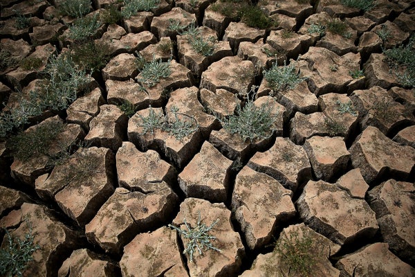
Droughts conjure images of vast expanses of hard, cracked soil and parched plants, but new research suggests that disastrous dry spells can develop over the wettest place of all: the ocean. Low-moisture air masses sometimes form and migrate thousands of kilometers over the sea, similar to the way hurricanes behave. These dry-air regions are less coherent, changing shape as they develop, however, and they move much slower. Some take more than half a year before they hit land, where they can destroy crops and threaten water security. Yet the long travel time means forecasters might be able to predict when this newly recognized type of drought will impact key regions, such as the western U.S.
“Thinking about droughts as a dynamic hazard is a new idea,” says environmental engineer Julio Herrera Estrada, who helped discover the phenomenon. He and his Stanford University postdoctoral advisor Noah Diffenbaugh describe what they have dubbed “landfalling droughts” in a study published this fall in Water Resources Research.
Herrera Estrada and Diffenbaugh made their discovery by retroactively following areas of relatively low atmospheric moisture worldwide, over both land and sea, from meteorological records between 1981 and 2018. “We watched them change shape from month to month and tracked how they moved in space and time,” says Herrera Estrada, who now focuses on sustainability as an applied scientist for Descartes Labs, which is based in Santa Fe, N.M. The researchers found that most areas of drought began and ended entirely over either the ocean or land. But one in six of the droughts afflicting continents turned out to have started over the ocean. “It’s not an obvious thing to wrap your head around. It’s a little counterintuitive to think about droughts over the ocean, because it’s wet,” Herrera Estrada says. “But there can still be lower rainfall over the ocean.”
On supporting science journalism
If you're enjoying this article, consider supporting our award-winning journalism by subscribing. By purchasing a subscription you are helping to ensure the future of impactful stories about the discoveries and ideas shaping our world today.
Drought has affected more of the world’s population than tsunamis, earthquakes or any other natural hazard in the past 40 years, killing and displacing people by the millions, according to the United Nations Food and Agriculture Organization. And landfalling droughts are particularly extreme, compared with conventional ones: on average worldwide, they can be one third drier and can grow nearly four times as fast and more than five times larger. The researchers did not investigate why they are more severe, but “one idea is that the atmospheric patterns responsible for landfalling droughts may themselves be different,” Herrera Estrada says. For example, the patterns that create and propel landfalling droughts may be larger than the patterns that drive those that form, and remain, over land.
The hotspots for landfalling droughts seem to include western North America, eastern South America, southwestern Africa and eastern Asia. The researchers are not yet sure why and say the factors that form and influence landfalling droughts may vary in different parts of the world. In western North America, for example, they found that these droughts are linked to areas of high pressure that block rainstorms and thus might initiate dry spells. Herrera Estrada speculates that as high-pressure areas shift, landfalling droughts may develop along their path. Once these droughts make landfall, high-pressure zones could then lock them in place. For example, a notorious high-pressure system called the “ridiculously resilient ridge” was stubbornly parked off the U.S. West Coast during much of California’s 2011–2017 drought—among its worst in recorded history.
Herrera Estrada and Diffenbaugh hope monitoring landfalling droughts will bolster prediction and preparation in California and other hotspots. “Seasonal forecasting is really hard,” says Julie Kalansky, a climate expert at the federally funded California-Nevada Climate Applications Program, who was not involved in the new research. She welcomes novel approaches to this problem and thinks tracking low-moisture areas over the ocean has promise because researchers can monitor a single factor—atmospheric moisture—instead of several. This is because atmospheric moisture is affected by other factors that can influence drought development, such as wind speed and sea surface temperature. The next step is to see how good of a predictor this measure ultimately is. “How reliable is it, and how much lead time does it give us?” Kalansky says.
Chris Funk, who develops drought early-warning systems for African countries and was not involved with the new research, is all set to find out. “I’m a big fan of this work—it’s really exciting,” he says, adding that landfalling droughts are potentially quite predictable as a result of their relatively long lead time. “We’re going to need that because climate change is making droughts more severe.” Funk, director of the Climate Hazards Center at the University of California, Santa Barbara, plans to expand his African early-warning systems to include landfalling droughts, which will entail tracking them hundreds or even thousands of kilometers offshore. “One of the things that’s appealing about this work is that the data are already there. There’s an incredible array of satellite observations,” he says. “Landfalling droughts give us a new pattern to look for.”